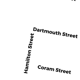
6 CORAM STREET
Owner Information
THOMAS KATIA
2633 ANDERSON DRIVE
DIGHTON, MA 02715


Property Details
6 CORAM STREET is classified as a APT 4-8 UT M94 (Aptoldstyle 6+unts).
The primary structure on this property was built in 1900. There are 5,216ft2 of built area within this property. There is 3,145ft2 of residential/living space within this property.
6 CORAM STREET is valued at $355,900. The land is valued at $77,200 and the structures are valued at $278,700.
This property is in Zone 3.33. Confirm with local Zoning Board authorities to ensure there are no overlays or other easements on this property.
The most recent deed for 6 CORAM STREET is recorded at the local registrar in Book 19823, Page 0224. 6 CORAM STREET was last sold on Wednesday, December 14, 2011 for $200,000.
Assessment data from fiscal year 2021.
Flood Data
According to the FEMA National Flood Hazard Layer, this property does not appear to be in a flood zone. It may also be in an area not yet reviewed. Nonetheless, confirm this information prior to taking any action.
To view the flood hazards around this property, create a FEMA "Firmette" Map of the area around 6 CORAM STREET.
Broadband Internet Providers
| Provider | Type | Bandwidth (mbps) | |
|---|---|---|---|
| HughesNet | Satellite | 25 | 3 |
| VSAT Systems, LLC. | Satellite | 2 | 1 |
| GCI Communication Corp. | Satellite | 0 | 0 |
| Comcast | Cable | 1000 | 35 |
| Verizon New England Inc. | Fiber | 940 | 880 |
| Verizon New England Inc. | DSL | 10 | 1 |
| Viasat Inc | Satellite | 100 | 3 |
Broadband service provider data from December 2020.
Adjacent Properties
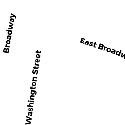
- 114 BROADWAY
APT 4-8 UT M94 owned by DAAKLIS LLC - 116 BROADWAY
APT 4-8 UT M94 owned by MEDEIROS CARLOS M & NELIA M - 3 BRADFORD STREET
Single Family Residential owned by SANSON JEFFREY - 5 BRADFORD STREET
Two-Family Residential owned by RODERGUES MARCELINO C & ARLET - 8 CORAM STREET
Two-Family Residential owned by TURNER SETH K - 112 BROADWAY
Three-Family Residential owned by BARROS ANGELINO